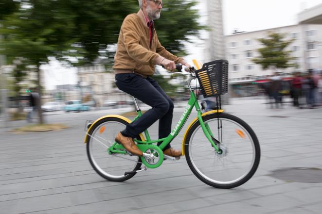
By joining the MegaBITS project, Le Havre Seine Métropole is dedicated to promoting cycling in the region and has established clear objectives. As of 2016, the modal transport split indicated that merely 1.4% of all journeys in the area were made by bicycle. Consequently, Le Havre Seine Métropole aims to revitalize its cycling infrastructure, striving for 8% of all journeys to be conducted by bicycle by the year 2026, with a further increase up to 12% by 2030. To achieve this, Le Havre Seine Métropole will implement several pilots in collaboration with MegaBITS which have been explained below.
Pilot 1: Data Sources and Tools
This pilot consists of 3 sub-pilots:
1.1: GPS Data Source
Le Havre Seine Métropole aims to implement GPS tracking systems on its "LIA" bike fleet to gather data from users' journeys. Through the collected GPS data, Le Havre Seine Métropole will extract information such as route details, speed, fluidity, origin/destination points, distance and frequency.
Additionally, Le Havre Seine Métropole seeks to obtain specific user information, including age, gender, location, personal situation, license ownership, car ownership, and other relevant details.
This comprehensive dataset will enable to assess the representativeness of the collected data and analyse specific user habits effectively.
1.2: Apps Data Source
The goal of this pilot is to collect raw data from bike users coming from different and complementary apps to create data sources in order to feed the data analyses tools (implementation 1.3)
The Apps considered as potential:
- Géovélo (for regular bikers)
- Google maps (for regular users)
- Strava* (for sportsmen’s)
- Komoot (for sportsmen’s and tourists)
1.3: Data Analysis Tools
The objective of this pilot is to create innovative and interactive analysis tools using the data collected in implementation 1.1 and 1.2. Thanks to these tools Havre Seine Métropole aims to learn more about:
- Traffic (to adapt bright, learn about distance average, avoid roads)
- Wrong Ways (to reveal potentially dangerous traffic)
- Speed (to improve fluidity, adapt curves)
- Attraction Points Maps (to facilitate parking)
- Attraction Area (to learn on behaviours)
- Black Spots (to improve safety and bicycle usage)
- Journeys paths between two points (to learn on behaviours, prospection, make evaluation, have feedback on our projects, deduce main paths and black points, make priority)
These tools can be implemented in 4 maps: interactive journey map, attraction points map, speed map and interactive traffic map.
This information will assist Le Havre Seine Métropole in the selection of high-potential projects, prioritization, analysis, and enhancement of unforeseen weaknesses. It will also aid in adapting our bike paths to better suit users, obtaining feedback on our projects, and adjusting our bike path infrastructure guide. The data will play a dual role: focusing on high-potential bike path projects and evaluating the advantages and disadvantages of our initiatives to enhance our planning capabilities. Additional information like age range, gender, car user, public transport user, situation (student / retired / other) will help us to adapt our services and to develop more inclusive bike paths.
Pilot 2: Artificial Intelligence Counters
Le Havre Seine Metrópole aims to utilize Artificial Intelligence (AI) on the one hand to acquire information on speed and, on the other hand, to gather details about the type of bike. If possible, Le Havre Metropole seeks to identify the proportion of e-bikes, tourists on itinerant journeys, cargo bikes, and bikes with children onboard.
Pilot 3: Bike Parking
Le Havre Seine Metrópole will also implement a clever system on the existing bike parks, which will be able to improve safety, give information about availability and help maintenance. The available place will then be shared with other apps, like Géovélo for example, for the rider’s ease.